Home of Arizona Brevets and Long Distance Cycling
|
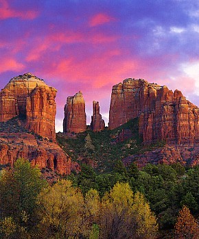
The beauty of Sedona is hard to match. REGISTRATION:
Registration is closed or not yet open. |
| Mingus Squared 200k |
||||||||
Date: Saturday, April 19, 2025
Distance: 126 miles Start Time: 7:00 AM Time Limit: 13.5 hours Sunrise: 6:04 amSunset: 6:47 pm Moonrise: 2:24 am. Waning Crescent with 12% of the Moon's visible disk illuminated. Moonset: 4:51 pm Cost: $15 All riders must pre-register. There is no day-of-event registration. ACP sanctioned. WAIVER NOTE: You will be automatically directed to the online waiver after you submit your PayPal payment. If you are not automatically directed to the online waiver after your pay, you may press the "Return to Merchant" button to sign the waiver. The online waiver may also be found at tinyurl.com/AZBrevetWaiver. REGISTRATION NOTE: Once you are registered for a ride, you will see your name in the Registered Riders tab. It may take a day or so for it to appear. Registered riders WILL be sent a "Last Minute Notes" email the day after registration closes, normally the Thursday before the ride. If you do not receive it, please let me know. Also, check your spam folder for the email. RIDE VERIFICATION: All of these events
are sanctioned by Randonneurs USA (RUSA).
As such, all of them will be verified using approved RUSA
methods. Click HERE
to see the details of available options for AZ Radonneurs'
events. Description
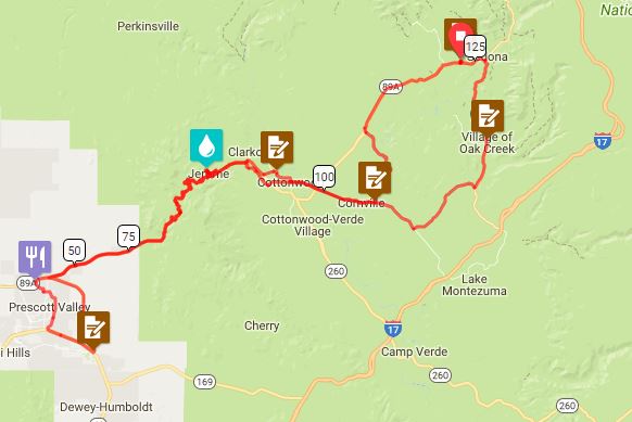
This route starts in Sedona. It will first visit one of Arizona's wine producing regions in Page Springs and Cornville. These sleepy hamlets are beautiful hidden spots. After wine come the climbs! We will start our first ascent of Mingus Mountain by riding through the hippy town of Jerome. It's a fun town to visit, but we'll just pass thru as we head up to the 7030' summit. Take a look around on the 10 mile descent because you'll be going back up it in a couple hours. We'll take a quick tour of Prescott Valley while our legs recover a bit. Soon we'll be climbing Mingus the "easy" way back to the summit. The descent down to Cottonwood is some of the most fun you can have on a bike! The route takes the "scenic route" back to Sedona by going back thru Cornville then riding straight into the Red Rock beauty of the Village of Oak Creek and Sedona. Don't forget your cameras! Terrain: The route is heavy on the climbing with summits of Mingus Mtn in both directions. There are also plenty of other climbs that don't show up in the profile, but will be very apparent in your legs. Don't burn too many matches too early. Just enjoy the beauty of Arizona's high country. Directions to the start Location: Bashas Grocery: Sedona, AZ Address: 160 Coffee Pot Drive; Sedona, AZ Directions: Google map: Click hereFrom Phoenix: I-17 to Exit 298 onto AZ-179 N to Sedona, AZ
Cue sheets may be downloaded and printed by riders if they wish. Cue sheets will NOT be passed out at the start. Make sure you have a cue sheet as a backup in case your GPS fails. Elevation Profile Total elevation gain for the 200k is ~10,000 feet.
It kinda looks like there are only 2 climbs. That would be a lie! Requirements Lights: We will start in daylight so lights and reflective vest/ankle bands are not required at the start. Services Services will be available at regular intervals, except on the Mingus climbs. You should make sure you top up your bottles in Jerome on the first summit. 1 Registered Riders.
|


