Home of Arizona Brevets and Long Distance Cycling
|
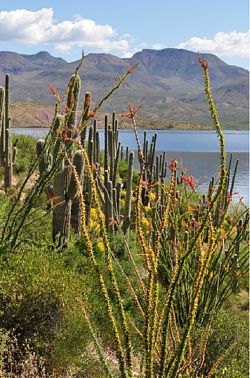
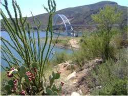
Rosevelt Lake at the dam. (Photo courtesy Tom Baker.) REGISTRATION:
Registration is closed or not yet open. |
| Mines to Pines 200k |
||||||||||||
Date: Saturday, February 7, 2026
Distance: 126 miles Start Time: 06:00 Time Limit: 13.5 hours Sunrise: 07:19Sunset: 18:08 Cost: $15 ACP sanctioned. WAIVER NOTE: You will be automatically directed to the online waiver after you submit your PayPal payment. If you are not automatically directed to the online waiver after your pay, you may press the "Return to Merchant" button to sign the waiver. The online waiver may also be found at tinyurl.com/AZBrevetWaiver. REGISTRATION NOTE: Once you are registered for a ride, you will see your name in the Registered Riders tab. It may take a day or so for it to appear. Registered riders WILL be sent a "Last Minute Notes" email the day after registration closes, normally the Thursday before the ride. If you do not receive it, please let me know. Also, check your spam folder for the email. RIDE VERIFICATION: All of these events
are sanctioned by Randonneurs USA (RUSA).
As such, all of them will be verified using approved RUSA
methods. Click HERE
to see the details of available options for AZ Radonneurs'
events. Description
Mines to Pines covers a range of climates and offers diverse scenery on good roads. Directions to the start Location: Walmart, Claypool AZ Address: 100 S Ragus Rd, Claypool, AZ 85532 Directions: Wal-Mart parking lot on US 60 in Claypool (between Miami and Globe, 1/2 mile west of AZ188 jct.)Google Map: https://goo.gl/maps/pFQMjMP9w992
Cue sheets may be downloaded and printed by riders if they wish. Cue sheets will NOT be passed out at the start. Make sure you have a cue sheet as a backup in case your GPS fails. (Excel sheet is not available.) Elevation Profile Total climbing 9850 ft!
Requirements - Riders are expected to do simple repairs such as repair a flat tire. Services - Services are abundant along this route even though it is extremely remote. All services are shown on the map, on the cuesheet and in the GPS file if you download it. 2 Registered Riders.
|