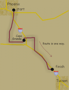
Tucson – Phoenix 208 km

Tucson to Phoenix
Starts at Cortaro Rd and I-10 in Tucson. Ride ends in Phoenix at Ray Rd and 56th Street (Priest). Food and hotels at both locations.
Description: Route travels between the cities of Phoenix and Tucson through the Sonoran Desert. Route is one way. To return to the start of this permanent ride the Phoenix to Tucson permanent.
Distance: 208 km (130 miles)
Services and Checkpoints: Convenience stores every 20-30 miles and 1 informational checkpoint.
Best time to go: October to April.
No freeway riding. Most roads are either low traffic or have a shoulder.
Elevation: The climb up Gates Pass at the start of the ride will get your heart pumping and the sight of Saguaro National Park will make your heart sing. After that it’s pancake flat to rolling through agricultural fields of Marana and then the dusty desert of Casa Grande.
Total climbing is 1,653 feet and descending is 2,608 feet, so it’s more downhill to Phoenix than uphill once you get out of Tucson.
