Home of Arizona Brevets and Long Distance Cycling
|
Leaving Show Low on US 60. Photo courtesy Bruce Chandler. REGISTRATION:
Registration is closed.
|

| High Country |
||||||||||||||||||||||||||||||||||||||||||||||||||||||||||||||||||||||||||||||||
Date: Saturday, August 16, 2014
Distance: 125 miles Start Time: 6:00 am Time Limit: 13.5 hours Sunrise: 5:42 AMSunset: 7:06 PM Cost: $20 RUSA sanctioned. WAIVER NOTE: You will be automatically directed to the online waiver after you submit your PayPal payment. If you are not automatically directed to the online waiver after your pay, you may press the "Return to Merchant" button to sign the waiver. The online waiver may also be found at tinyurl.com/AZBrevetWaiver. REGISTRATION NOTE: Once you are registered for a ride, you will see your name in the Registered Riders tab. It may take a day or so for it to appear. Registered riders WILL be sent a "Last Minute Notes" email the day after registration closes, normally the Thursday before the ride. If you do not receive it, please let me know. Also, check your spam folder for the email. RIDE VERIFICATION: All of these events
are sanctioned by Randonneurs USA (RUSA).
As such, all of them will be verified using approved RUSA
methods. Click HERE
to see the details of available options for AZ Radonneurs'
events. Description
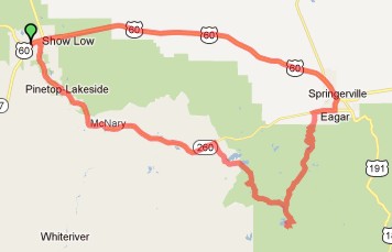
This route is one large loop starting and ending in Show Low, AZ. The loop passes through rolling grassland to the Springerville/Eager area, after which it enters the White Mountain lake country with a stop at Big Lake, and then returns to Show Low.
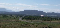
Leaving Show Low and heading for Springerville, AZ. Photo courtesy Bruce Chandler. Directions to the start Location: Safeway in Show Low Address: 900 W. Deuce of Clubs, Show Low, AZ Directions: Safeway is just north of the intersection of routes 260 and US 60, and just south of the Days Inn where we used to meet.
Cue sheets may be downloaded and printed by riders if they wish. Cue sheets will NOT be passed out at the start. Make sure you have a cue sheet as a backup in case your GPS fails. Elevation Profile
5,380 feet of climbing. Highest point on the route is 9, 500 feet above sea level. Requirements Lights: Optional. However, if you're still riding after sunset, you need lights as required by law Services The first store you are likely to encounter is about 47 miles into the ride. After that, there are services every 25-40 miles. You'll find services in Springerville, Eager, Big Lake, Hon Dah Casino, and Pine. A hydration system is highly recommended. 19 Registered Riders.
|