Jul
2
2010
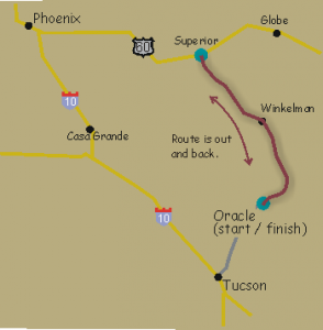
Description: Route is out and back.

Oracle to Superior
Starts at the Circle K in Oracle (north of Tucson).
Distance: 212 km (132 miles)
Services and Checkpoints: Convenience stores every 35 miles.
Best time to go: October to April.
No freeway riding. Most roads have a shoulder or are low traffic, though you should keep alert on the stretch through Mammoth.
Elevation: Rolling for the first 34 miles to Winkelman. Then hilly to Superior. Total elevation gain is 8,424 feet.
Be the first to review | Region: Mining Towns
Jul
2
2010

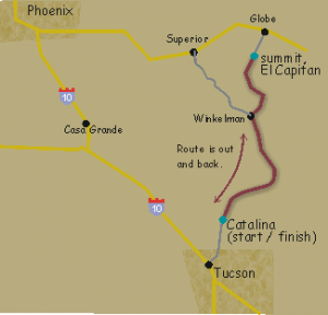
Ride to El Capitan
Starts at the McDonalds in Catalina, just north of Tucson.
Description: Route is out and back. The turnaround is at the summit just south of Globe.
Distance: 227 km (141 miles)
Services and Checkpoints: Convenience stores every 35-45 miles.
Best time to go: October to April.
No freeway riding. Most roads have a shoulder though you should keep alert on the stretch through Mammoth.
Elevation: Rolling for the first 34 miles to Winkelman. Then a big climb up to the turnaround on El Capitan. Coming back there’s a 10-mile climb out of Mammoth. Total elevation gain is 8,364 feet.
Be the first to review | Region: Mining Towns

